
You will see the next disaster coming.

Gistin builds a 3D digital twin of your territory and sells three applications on top of it: GISFlood for floods, GISFire for wildfires, GISLightning for lightning. Each one tells you what will hit your site, so you can act before it happens.

For governments, infrastructure operators, developers, insurers and emergency services.

Three hazards, one engine

Digital twin

One 3D twin of your territory. Every hazard runs on it.

GISTwin is the high-fidelity 3D twin of your area: terrain, buildings, roads and networks. Rain, fire and lightning scenarios play out on it, on live, historical or forecast weather, and every result is compared with the reference situation, so the decision can be defended in a budget.

  • A vulnerability score per building, run after run
  • Submersion points on the road and rail network
  • Decision dashboards and the alerts you configure

What you get

Your territory is modelled once, then the applications you need are added on top. A pilot on one district or asset first, then an annual licence.
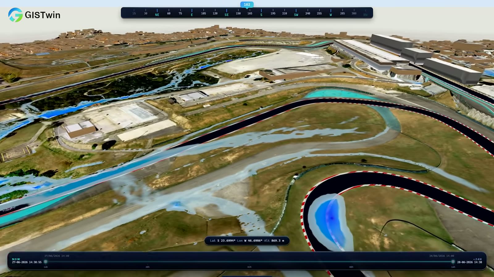

GISTwin

for floods, wildfires and lightning
1 twin
for floods, wildfires and lightning
a vulnerability score and a water depth
Per building
a vulnerability score and a water depth
in production in the United Arab Emirates

Abu Dhabi
in production in the United Arab Emirates

Floods

See every street that will flood. Test the fix before you pay for it.

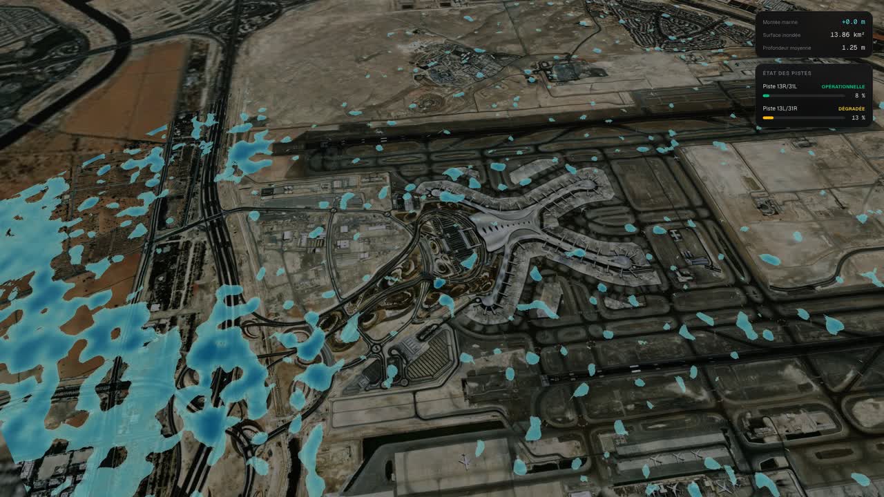
In April 2024, close to two years of rain fell on the UAE in under 24 hours. GISFlood replays storms like this one on a 3D twin of your site and shows where the water goes, how deep and how fast.

  • Water depth and time of arrival at every building and street
  • 10, 50 or 100-year storms, with or without drainage
  • Your proposed fix tested against the same storm, compared with today

What you get

A pilot on one district or asset in six to eight weeks, then an annual licence for your territory. Browser app in development, end of 2026.

GISFlood

of rainfall in under 24 hours
≈ 2 years
of rainfall in under 24 hours
the heaviest rainfall ever recorded
75 years
the heaviest rainfall ever recorded
a world-leading airport, at a standstill
Grounded
a world-leading airport, at a standstill

Wildfires

Every active fire, live. Alerts on the zones you protect.

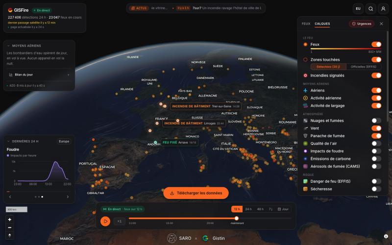
GISFire puts satellite fire detections, firefighting aircraft, water drops and wind on one live map. We built it when the trees of our own Landes forest burned. The public map stays free and open to everyone; GISFire Pro watches the zones you choose and alerts you.

  • Satellite detections every few minutes, forest and industrial fires
  • Aircraft, water drops, wind and lightning strikes on the same map
  • Seven days of replay, fire by fire, with downloadable data

What you get

Public map: free, no account. GISFire Pro: alerts on your zones from €12 per month excl. VAT, for France and Europe. Fire data and maps on request.

GISFire

forest and industrial fires, lightning included
Worldwide
forest and industrial fires, lightning included
of requests absorbed at the peak, without the map going down
Millions
of requests absorbed at the peak, without the map going down
of replay, fire by fire
7 days
of replay, fire by fire

Lightning

Know which of your structures lightning will hit, before the season.

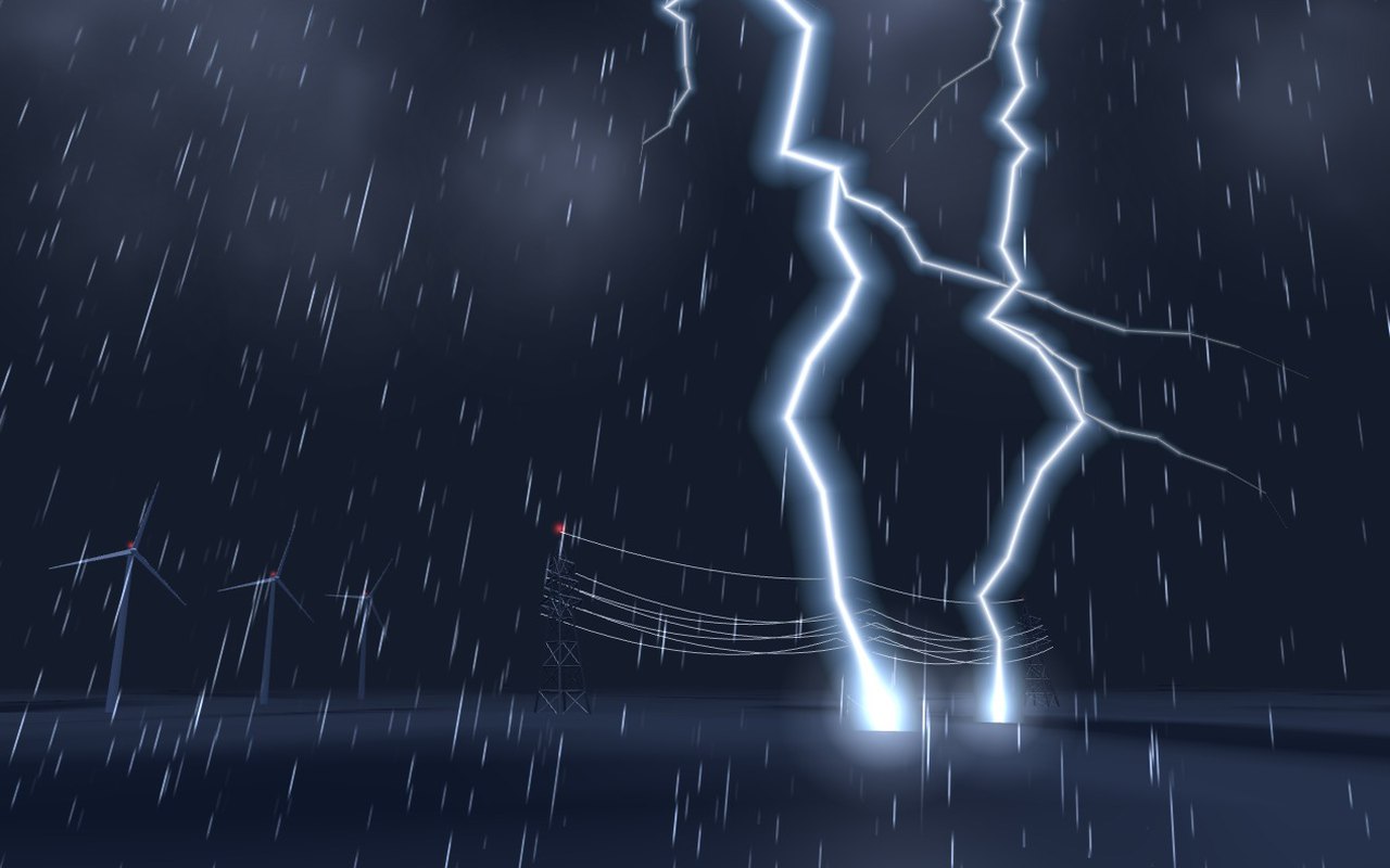
Several organisations asked us to assess lightning ahead of time for specific sites. GISLightning maps where strikes cluster around your site and how exposed each structure is, so the decision is taken before the storm, not after.

  • Strike density around your site, from years of records
  • Exposure of each structure: masts, lines, tanks, roofs
  • A written assessment, delivered before the season

What you get

One assessment per site, quoted on request. Web application in development.

GISLightning

plotted on the live map, beside the fires
Every strike
plotted on the live map, beside the fires
of strike records behind every density map
Years
of strike records behind every density map
a written report before the season
Per site
a written report before the season

Awards and distinctions

The research behind Gistin

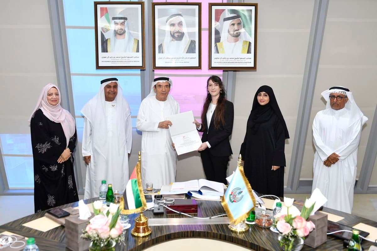
G3DAR, the award-winning research project behind Gistin, recognised by the Emirati Society of GIS and Remote Sensing in collaboration with the Mohammed Bin Rashid Space Centre.

ESGRS Challenge: Earth Observation Edition award ceremony

@UAEU_NEWS · May 3, 2024

H.E. Zaki Anwar Nusseibeh honors student Justine Sarrau for 1st place in the ESGRS Challenge organized by MBRSC.

View on X

  1. 1st prize · ESGRS Challenge, Earth Observation Edition

    Emirati Society of GIS and Remote Sensing, with the Mohammed Bin Rashid Space Centre · October 2023

    G3DAR · the research project behind Gistin

  2. Best Poster Award

    Eighth International Symposium on Flash Floods in Wadi Systems (ISFF8) · November 2024

    Dr. Justine Sarrau · flash floods in wadi systems

How to buy

Start with one hazard on one site.

All three applications run on GISTwin, the same 3D twin of your territory. Model it once, then add the hazards you need. Every result is compared with the reference situation, so the decision can be defended in a budget.

  • GISFlood
    What you buy
    Pilot on one district or asset, then annual licence
    What you receive
    Flood risk map, exposed buildings and roads, one fix tested
    Status
    Pilots now · app end of 2026
  • GISFire
    What you buy
    GISFire Pro subscription, from €12 per month, France and Europe
    What you receive
    Alerts on your zones: fires, smoke, lightning, press
    Status
    Live · global coverage
  • GISLightning
    What you buy
    Assessment per site, quoted on request
    What you receive
    Strike density and exposure of each structure, in a report
    Status
    On request · app in development
  • GISTwin
    What you buy
    The 3D twin of your territory, under every application
    What you receive
    Per-building scores, network submersion points, decision dashboards. Model your territory once, then add the hazards you need
    Status
    In production · UAE

Mission brief

Tell us your hazard and your site.

We reply as soon as possible with a 30-minute demo slot and a first scope: a pilot, a subscription or an assessment.

We reply as soon as possible · contact@gistin.ae