
 GISFire
Every active fire, live. Alerts on the zones you protect.
- forest and industrial fires, lightning included
- Worldwide
- forest and industrial fires, lightning included
- of requests absorbed at the peak, without the map going down
- Millions
- of requests absorbed at the peak, without the map going down
- of replay, fire by fire
- 7 days
- of replay, fire by fire
What it does
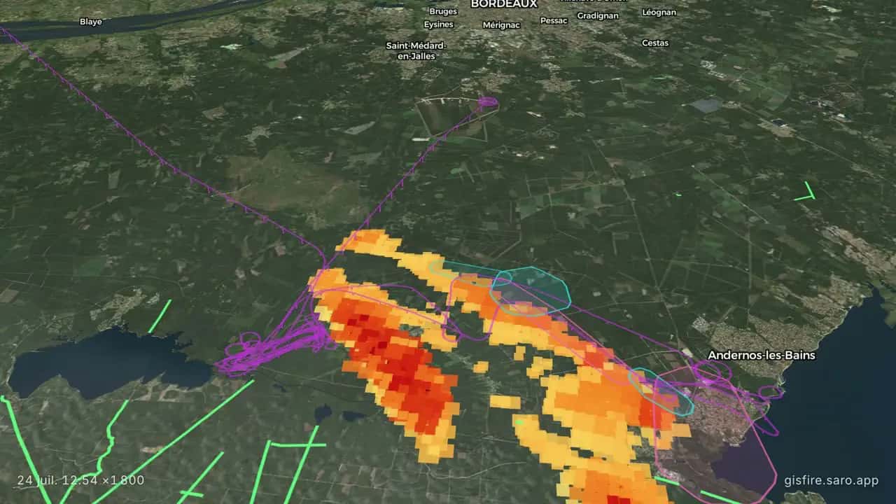
GISFire puts satellite fire detections, firefighting aircraft, water drops, lightning and wind on one live map, clustered into fire events, with AI cross-checking of the news to confirm each fire and a seven-day replay. The public map is free, with no account, and entirely volunteer-run.
GISFire Pro watches the zones you choose and alerts you: fires, smoke, lightning and press, from €12 per month excluding VAT, for France and Europe. Fire data and maps are available on request. Detections land roughly three hours after satellite acquisition: GISFire is a situational-awareness tool, not an operational alerting system.
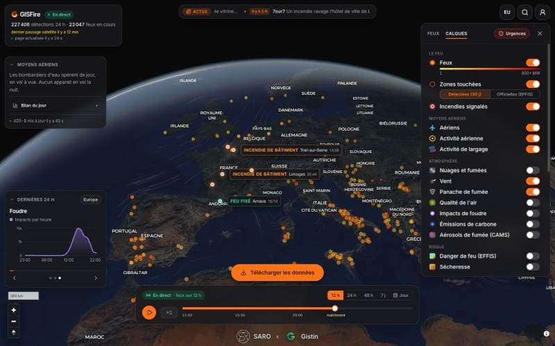
- Satellite detections every few minutes, forest and industrial fires
- Aircraft, water drops, wind and lightning strikes on the same map
- Seven days of replay, fire by fire, with downloadable data
Who it serves
- Firefighters and civil protection
- Foresters and land managers
- Industrial sites near vegetation
- Insurers and loss adjusters
- Journalists and local authorities
- The public: free, no sign-up
The science behind it
The documentation method behind GISFire is published: a historical database of forest fires in Gironde and Les Landes (1989-2022) built from the press and cross-checked against burned areas visible on Landsat and Sentinel-2 imagery, with a hazard map weighting vegetation water content, vegetation type, topography and access (ISPRS Annals, 2025).
The live map applies the same discipline to the present: every detection carries its satellite and acquisition time, every fire event its radiative power, and the AI press cross-check cites its sources. During the summer 2026 season the map absorbed millions of requests and hundreds of thousands of people used it.
All products
 The high-fidelity 3D twin of your territory, under every application.Discover
 GISFloodFlood simulation of your site, street by street, before the storm.Discover
 GISLightningLightning exposure of your assets, site by site, before the season.Discover
 GISSpaceSpace weather and orbital traffic, live on one globe.Discover